Introduction
A cloudburst is one of the most terrifying and sudden weather events that nature can unleash. In recent years, especially during the monsoon season, different parts of the world have experienced unexpected cloudbursts that cause destruction within minutes. The year 2025 has already seen several instances of extreme weather activity, and cloudburst events are becoming more frequent due to climate change. Tech-enabled weather monitoring systems and modern satellite tools are helping scientists understand the early signs related to cloudbursts, but awareness among people is still limited. That is why it is important to know what a cloudburst is, how it forms, and why it leads to such violent rainfall.
In today’s technology-driven world, real-time data and predictive analytics offer useful insights about changing weather patterns. However, even with advanced tools, a cloudburst remains one of the hardest phenomena to predict. Most people confuse heavy rainfall with a cloudburst, when in reality a cloudburst involves an intense downpour of rain in a very short time over a small area. It usually happens in hilly regions where warm, moist air rises rapidly and meets cold air layers in the atmosphere. When this cycle becomes too strong, massive clouds break suddenly, releasing an enormous amount of rain.
The purpose of this article is to give a clear explanation of cloudburst incidents, especially in 2025, and discuss how they affect the environment and local communities. You will also learn the difference between a normal rainfall event and a cloudburst, along with practical tips to stay safe when such an event occurs. With accurate knowledge and smart use of technology, we can reduce the impact of future cloudburst disasters and better prepare ourselves for extreme weather situations.
What Is a Cloudburst?
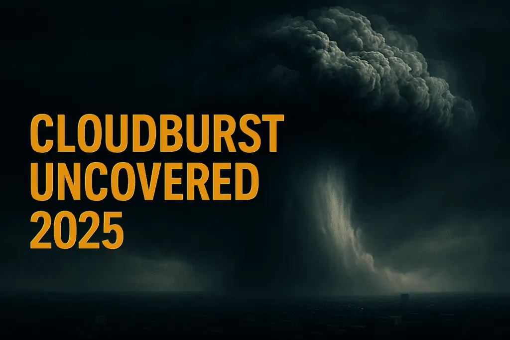
A cloudburst is an intense and highly localized weather event where a massive volume of rain falls in a very short period of time, often less than an hour. Unlike regular rainfall that spreads over a wider area and continues for several hours, a cloudburst targets a small region and releases water at an extremely high rate. During a cloudburst, rain intensity can exceed 100 mm within an hour, which is enough to trigger flash floods, landslides, and severe damage to infrastructure. This sudden burst of heavy rainfall leaves very little time for people to respond, making it one of the most dangerous forms of natural disasters.
The term cloudburst is commonly associated with hilly or mountainous areas because such regions provide perfect conditions for rapid condensation of warm, moisture-filled air. When this warm air ascends and meets cooler temperatures at higher altitudes, the moisture quickly forms dense clouds. If these clouds become too heavy and unstable, they suddenly release their accumulated water in the form of a cloudburst. What makes this event particularly alarming is the absence of clear warning signs. Even advanced meteorological tools struggle to accurately predict the exact location and time of a cloudburst.
In 2025, experts have observed an increase in extreme weather events, and the cloudburst phenomenon is one of the most concerning trends. Climate change, rising temperatures, and unpredictable weather patterns are contributing factors that make cloudbursts more frequent and intense. Understanding what a cloudburst is and how it occurs is the first step toward disaster preparedness. With the right technology and real-time monitoring, authorities can provide quick alerts and help reduce loss of life and property. This section aims to give readers a clear understanding of the cloudburst phenomenon and why it demands serious attention.
Causes of Cloudbursts
Understanding the causes of a cloudburst is essential to recognize why these sudden and violent rain events occur. The primary cause of a cloudburst is the rapid upward movement of warm, moisture-laden air. When this warm air rises quickly into the cooler regions of the atmosphere, it condenses and forms dense, heavy clouds. In most cases, the condensation process is gradual and results in regular rainfall. However, in a cloudburst, the condensation happens rapidly and the cloud becomes saturated in a short time. When it can no longer hold the accumulated moisture, it releases massive amounts of rain in one sudden burst.
Geographical features also play a major role in cloudburst formation. Mountainous and hilly regions act as natural barriers that force warm air to rise abruptly. This is why cloudburst incidents are frequently reported in areas such as the Himalayas. The steep slopes in such regions cannot absorb water quickly, which results in flash floods immediately after a cloudburst. Another contributing factor is the presence of low-pressure zones. These zones attract moist air from surrounding regions and intensify the formation of thick rain-bearing clouds.
In recent years, climate change has become a significant factor in the increasing number of cloudburst events. Rising global temperatures add more moisture to the atmosphere and disturb the natural balance of weather systems. This creates unstable atmospheric conditions that make cloudburst incidents more likely. Additionally, deforestation and rapid urbanization reduce the natural ability of land to absorb excess rainwater, causing even more damage during a cloudburst.
Human activities combined with natural atmospheric processes are creating an environment where cloudbursts occur more frequently. Studying these causes helps researchers and meteorologists improve early warning systems and educate people living in high-risk areas. Better awareness and preparedness can significantly reduce the impact of future cloudburst disasters.
Impact and Destruction Caused by Cloudbursts
The impact of a cloudburst is often immediate and devastating due to the sheer volume of water released in a short time. One of the most serious effects is the rapid onset of flash floods. When a cloudburst occurs, local rivers and streams overflow instantly, turning roads and residential areas into dangerous flood zones within minutes. This sudden rise in water level leaves little time for evacuation, causing loss of life and significant property damage. In hilly regions, where most cloudburst incidents occur, the force of flowing water can trigger landslides that destroy houses, bridges and essential road networks.
Another major destructive consequence of a cloudburst is the disruption of communication and power supply. Flooded roads and damaged infrastructure isolate affected areas, making rescue and relief operations extremely difficult. Emergency services often struggle to reach cloudburst-hit regions due to fallen trees, blocked routes and collapsing bridges. In rural and remote locations, people are completely cut off for several hours or even days, which worsens the crisis.
A cloudburst also severely impacts the natural environment. The sudden downpour erodes topsoil, destroys crops and damages vegetation. Livestock are washed away or injured in the floodwaters, affecting the livelihood of local communities. Moreover, contaminated floodwater increases the risk of water-borne diseases such as cholera and typhoid, creating additional health challenges in the aftermath of a cloudburst.
In 2025, as cloudburst events become more frequent, their destructive impact is being felt across more regions. Rapid urbanisation and poorly planned constructions further amplify the damage as drainage systems are unable to handle such massive water flow. Understanding the destructive impact of a cloudburst highlights the urgent need for better planning, early warning systems and community awareness programmes, so that vulnerable regions can minimise loss of life and property during future extreme rainfall events.
Cloudburst Prone Regions in the World
Cloudburst incidents are most commonly reported in mountainous and hilly regions because these areas create ideal conditions for rapid air uplift and condensation. One of the most well-known cloudburst prone regions in the world is the Himalayan belt, especially parts of Northern India, Nepal and Bhutan. In states such as Uttarakhand, Himachal Pradesh and Jammu & Kashmir, the steep slopes and moist monsoon winds often trigger a cloudburst during the rainy season. These areas face repeated destruction every year, and 2025 has already recorded several cloudburst events in this region.
Another major cloudburst hotspot is the Andes mountain range in South America. Countries like Colombia, Peru and Chile have experienced intense rainfall events similar to a cloudburst, particularly in high-altitude valleys. The rugged terrain and strong convective activity in the atmosphere make these regions vulnerable to sudden downpours. In the European Alps, Switzerland and Austria have also reported smaller-scale cloudburst incidents that caused flash floods and localized damage.
Apart from mountainous terrain, some coastal areas with tropical climates are also prone to a cloudburst because of the high moisture content in the atmosphere. The Indonesian archipelago and the Philippines occasionally witness intense cloudburst-like rainfall triggered by tropical storms. Although the total area affected is smaller compared to a full-scale storm, the rain intensity is high enough to cause major flooding and landslides.
In North America, regions near the Rocky Mountains and certain parts of Alaska have reported cloudburst behaviour in recent years. Climate scientists link these events to rising global temperatures that increase moisture levels in the atmosphere and create unstable weather conditions. Understanding which areas are most at risk allows governments and disaster management agencies to deploy early warning systems more effectively and educate local populations about the dangers of a cloudburst.
Recent Cloudburst Incidents in 2025
Cloudburst events in 2025 have wreaked havoc in several regions, underscoring the growing challenge of extreme weather.
In mid‑August, a sudden cloudburst struck Chositi (also spelled Chashoti) village in Kishtwar district, Jammu & Kashmir, on August 14, 2025. The deluge triggered powerful flash floods that swept away a community kitchen and security post along the Machail Mata pilgrimage route. Authorities have confirmed at least 60 deaths, over 100 injuries, and more than 250 people remain missing. Rescue missions conducted by the army, police, disaster response teams, and volunteers have evacuated around 300 people, but the scale of devastation has made relief efforts extremely complex.
Earlier in August, on August 5, a cloudburst in Uttarkashi, Uttarakhand, triggered flash floods that devastated local infrastructure, including hotels and homes. At least five people were killed and dozens remain unaccounted for as rescue operations continue. Another shocking incident occurred in Dharali, Uttarakhand, where a cloudburst unleashed torrential rainfall of 21 cm, flattening buildings, sweeping away entire structures, leaving four confirmed dead and around 100 missing.
These incidents reflect how cloudburst events, though often highly localized, can produce catastrophic consequences. From high-altitude pilgrimage routes to remote Himalayan villages, no place seems immune. These disasters not only cause immediate loss of life and property but also disrupt community resilience and emergency response capacity.
Staying informed about such cloudburst events is crucial—not just as a tech blogger but as a voice for awareness and preparedness.
Difference Between Cloudburst and Heavy Rainfall
Many people assume that a cloudburst is the same as heavy rainfall, but there are important differences between the two. Heavy rainfall refers to a large amount of rain that falls over a wide geographical area, usually spread over several hours or even days. While heavy rainfall can cause flooding and waterlogging, it usually gives people enough time to react and prepare. In contrast, a cloudburst is a sudden and extremely intense downpour that occurs in a very small area and within a very short period of time. During a cloudburst, the rain intensity is so high that it can exceed 100 mm in less than an hour, overwhelming natural and man-made drainage systems instantly.
Another key difference between heavy rainfall and a cloudburst lies in the atmospheric conditions that trigger them. Heavy rainfall is generally associated with large weather systems such as monsoon depressions, cyclones or widespread storm systems. On the other hand, a cloudburst forms when warm, moist air rises rapidly and undergoes rapid condensation at higher altitudes. This rapid buildup of moisture creates highly unstable clouds. When these clouds can no longer hold the excessive moisture, they burst suddenly, resulting in a highly concentrated and violent downpour.
In terms of impact, heavy rainfall might lead to gradual flooding, whereas a cloudburst usually leads to immediate flash floods and landslides, especially in mountainous terrain. Because of this sudden impact, a cloudburst is far more destructive and dangerous than normal heavy rainfall. Even advanced meteorological systems find it difficult to provide timely alerts because cloudbursts develop and unleash their rain within a very short window.
Understanding the difference between heavy rainfall and a cloudburst enables people to better assess risk and prepare for extreme weather events. Awareness of these distinctions helps communities respond more effectively when confronted with sudden cloudburst situations.
Can We Predict Cloudbursts?
Predicting a cloudburst remains one of the biggest challenges in modern meteorology. While weather forecasting technology has advanced significantly in recent years, scientists still struggle to accurately predict the exact time and location of a cloudburst. This is because a cloudburst forms under highly localized and rapidly changing atmospheric conditions. Unlike large weather systems that can be tracked over several days, a cloudburst develops quickly when warm, moisture-rich air rises sharply and meets a colder air mass in the upper atmosphere. The entire process may take place within minutes, giving meteorologists very little time to issue precise warnings.
Current weather monitoring tools, such as Doppler radar, satellite imagery and high-resolution weather models, do provide useful data that can help identify regions with a high likelihood of a cloudburst. These tools can detect atmospheric instability and rapid cloud formation in real time. However, predicting the exact moment when a cloudburst will occur and how much rain it will release is still extremely difficult.
In 2025, research institutions and weather agencies are focusing on developing more advanced algorithms and AI-based prediction models to improve cloudburst forecasting. By analyzing patterns from previous cloudburst events and combining them with real-time atmospheric data, experts hope to provide earlier alerts to at-risk regions. Early warning systems, even if limited in precision, can still give valuable minutes to local authorities to warn people and prepare for evacuation.
Although it is not yet possible to predict a cloudburst with complete accuracy, continuous technological improvements are making forecasts more reliable. Increased public awareness, combined with better use of real-time weather alerts, can help reduce the destructive impact of a cloudburst. Understanding the current limitations and future potential of cloudburst prediction techniques is an important part of disaster preparedness.
How to Stay Safe During a Cloudburst
Staying safe during a cloudburst requires quick decision-making and awareness of immediate surroundings. The most important safety measure is to move to higher ground as soon as possible. Since a cloudburst causes sudden flash floods, low-lying areas become extremely dangerous within minutes. Avoid staying near rivers, streams or narrow valleys, as these locations are the first to get flooded during a cloudburst. If you are driving, stop the vehicle and stay on elevated sections of the road. Never attempt to cross a flooded road or bridge, because the water flow during a cloudburst is powerful enough to sweep away vehicles in seconds.
It is also crucial to stay informed by regularly checking weather updates and alerts from local authorities. Many regions prone to a cloudburst now have early warning systems that send notifications through mobile apps and radio broadcasts. Keeping an emergency kit ready at home can be life-saving. This kit should include essential medicines, a first-aid box, water, non-perishable food and important documents stored in waterproof packaging. During a cloudburst, power and communication lines often get disrupted, so it is useful to have a battery-powered torch and radio.
If you find yourself indoors during a cloudburst, stay away from windows and avoid using electronic appliances that are directly connected to electricity lines, as lightning may accompany the intense rainfall. In multi-storey buildings, move to the upper floors and stay there until the water level recedes. For people living in hilly areas, landslide risk is very high during a cloudburst, so remain alert for rumbling sounds or unusual ground movement.
By understanding potential risks and taking these immediate steps, you can significantly reduce the dangers posed by a cloudburst. Preparedness and awareness are the most effective tools to ensure safety during such sudden and violent weather events.
Conclusion
A cloudburst is one of the most intense and dangerous weather events that can strike without warning. As we have seen throughout this article, it is very different from normal rainfall due to its extremely high intensity and sudden onset. In recent years, especially in 2025, the frequency of cloudburst incidents has increased across several regions in the world. This rise is closely linked to changing climate patterns, global warming and rapid urban development. With more moisture in the atmosphere and unstable weather conditions, the likelihood of experiencing a cloudburst in previously unaffected areas has also grown.
While predicting the exact location and timing of a cloudburst remains difficult, modern weather monitoring systems and AI-based models are helping meteorologists issue more accurate alerts than ever before. Increased awareness and preparedness are critical factors that can reduce loss of life and property. People living in cloudburst-prone regions must pay close attention to weather updates and be ready to take immediate action when necessary.
Technology plays an important role in our understanding and response to extreme weather. Real-time data, remote sensors and satellite imagery provide valuable information that can save lives. However, every individual must also take responsibility for their own safety by following basic guidelines during a cloudburst. Moving to higher ground, avoiding flood-prone areas and keeping emergency supplies ready are practical steps that can make a big difference.
In conclusion, a cloudburst is a powerful reminder of nature’s unpredictability. By combining scientific knowledge with community awareness and preparedness, we can minimise the devastating effects of future cloudburst events. Staying informed, understanding the causes and recognising the signs of a cloudburst will help build safer and more resilient communities in the years to come.
Also Read: Mahindra BE 6 Batman Edition Unveiled: ₹27.79 Lakh Dark Knight SUV Limited to 300 Units.
FAQs – Cloudburst
Q1. What is a cloudburst and how is it different from normal rain?
A cloudburst is an intense and sudden downpour of rain that occurs in a very small area and lasts for a short time. Unlike normal rain, which spreads across a wide region and gives people time to react, a cloudburst releases an extraordinary amount of water in just a few minutes. This often leads to flash floods and severe destruction, especially in hilly regions.
Q2. Why do cloudbursts mostly occur in mountainous areas?
Cloudbursts generally happen in mountainous regions because warm, moisture-filled air rises rapidly from the ground and meets cooler air in the upper atmosphere. This sudden uplift creates highly unstable clouds. When these clouds become overloaded with moisture, they burst all at once. The steep landscape of these regions also prevents water from being absorbed quickly, resulting in dangerous flash floods.
Q3. Can we predict a cloudburst before it happens?
Predicting a cloudburst with exact accuracy is still a major challenge for scientists. While modern weather monitoring tools like Doppler radar and satellite systems can detect unstable atmospheric conditions, they often cannot determine the exact timing and location of a cloudburst. Researchers are using AI and real-time data analysis in 2025 to improve prediction models, but fully accurate forecasting is not yet possible.
Q4. What should I do if a cloudburst occurs while I’m outdoors?
If a cloudburst occurs and you are outdoors, move immediately to higher ground and avoid staying near rivers, streams or low-lying areas. Do not attempt to cross flooded roads or bridges. The water flow during a cloudburst is extremely powerful and unpredictable. Stay calm, find a safe elevated spot and wait for the water level to recede or for emergency teams to arrive.
Q5. Are cloudburst incidents increasing due to climate change?
Yes, climate experts believe that cloudburst incidents are becoming more frequent due to climate change. Rising global temperatures add more moisture to the atmosphere and create unstable weather conditions, especially in mountainous regions. These conditions increase the likelihood of a cloudburst. As a result, regions that were once considered low-risk may also experience such extreme rainfall events in the future.